Robbie’s of Islamorada History
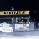
How Robbie’s Came To Be
Robbie and his wife Mona started feeding Scarface 18 years ago. Scarface appeared floundering in the shallow waters near the dock; Robbie saw the struggling tarpon and, thinking it had swum too shallow and gotten stuck on the bank, went out into the water to free it.
He lifted the fish and saw that the right side of its jaw was torn open. Hoping to revive the tarpon, Robbie placed it in the oxygen-rich shrimp tank and called old Doc Roach.
The doctor showed up with his wife’s mattress needles and some twine, and Scarface became the first known tarpon with stitches.
After several days of force-feeding, Scarface showed good recovery and weight gain; six months later, he was released into the waters off the dock.
Afterward, Scarface continued to frequent the docks, sometimes bringing a friend. Soon, more and more of the fish began to appear.
That’s how the history of Robbie’s started. Now, we were voted the number 1 place in The Keys that every tourist should visit.
Whether you want to hand-feed a massive tarpon, seek some thrills with our water sports, or stock up on handcrafted souvenirs at our fun, local shops, we’ve got something for everyone at Robbie’s!
Gorge fresh, delicious seafood and sip one of our signature cocktails, local draft beer, or our famous loaded Trailer Trash Bloody Mary on the waterfront deck of our Hungry Tarpon Restaurant and enjoy the show of the tarpon feeding frenzy!
As a must-visit destination in the Florida Keys, our site shares what to do and where to eat at Robbie’s Marina of Islamorada to help you plan your stop and create memorable moments with your family and friends.
Remember, it’s not a trip to the Keys without a visit to Robbie’s!
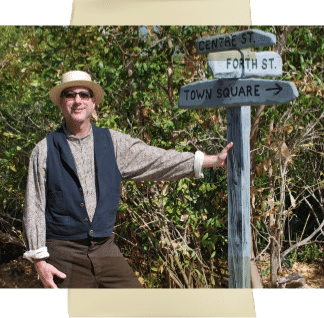
Meet Historian Brad Bertelli
a local historian, author, and Honorary Conch
This page is imbued with the diligent research and expert insights of Florida Keys Historian Brad Bertelli, a devoted chronicler of Islamorada’s colorful past. We are indebted to his expertise and passion for keeping the legacy of Islamorada alive for generations to come.

Voted the #1 Place To Visit In The Florida Keys
THIS IS OUR HISTORY!!
At Robbie’s, we believe in preserving the rich tapestry of our past, ensuring that history is never left behind. We are ardent admirers of Islamorada’s storied heritage and its colorful tales that have shaped our community.
2023
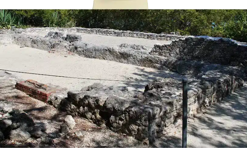
Indian Key Warehouse Ruins:
Just a 25-minute paddle from Robbie’s Marina is Indian Key Historic State Park. Visiting the island is like stepping back to a time when Indian Key was home to a thriving wrecking village of more than 100 people. Ruins of the former community are still visible, including the remnants pictured here of two three-story warehouses that were once the island’s largest structures.
1987
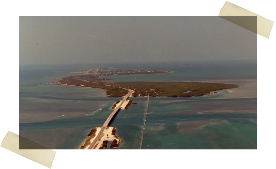
Lower Matecumbe Key Aerial
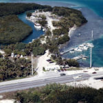
Things have changed on Indian Key Fill since this aerial image was taken on October 7, 1987. The little harbor has been filled in with more changes projected to occur in the near future. One thing that has not changed is that Robbie’s Marina is still a must-stop roadside attraction in the Upper Keys. Image courtesy of the Wright Langley Collection and Monroe County Library Collection.
1960
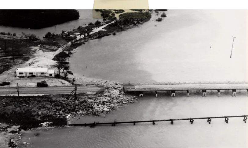
Lignumvitae Key Channel Bridge
The Robbie’s property was originally home to the Starck family, who moved to the island in the 1940s. They are considered to be the island’s first permanent residents. The image, part of the Wilhelmina Harvey Collection, was taken in 1960 after Hurricane Donna delivered her tremendous blow. The Category 4 hurricane washed out the Lignumvitae Key Channel Bridge. The building prominently shown in the image is the Starck Fishing Camp bait house. Today, it is home to the Hungry Tarpon. Things have certainly changed a bit at Robbie’s since 1960.
1945
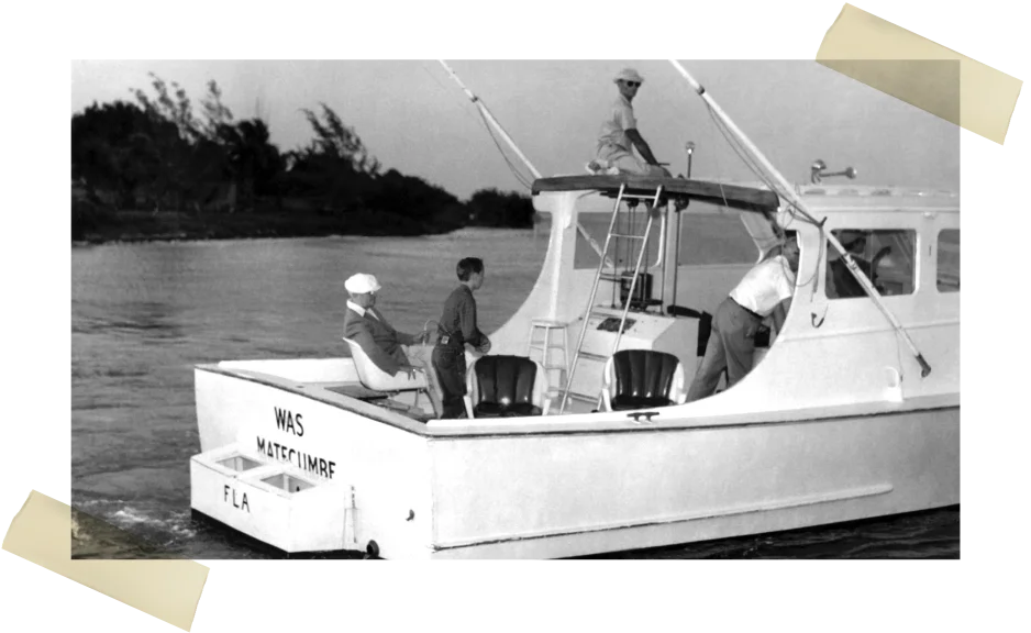
WAS (Walter A. Stark)
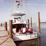
Walter and Ruth Starck bought the property known today as Robbie’s in the 1940s. In the summer of 1946, they started building a house. Later, Buck and his wife’s brother, Ellis Shires, built a bait and tackle store that Buck’s wife, Ruth, used to run. That store is known today as the Hungry Tarpon. Walter “Buck” Starck operated his fishing charter boat WAS (Walter A. Stark) out of the small marina. In this image, the WAS can be seen leaving Starck’s marina. Buck is at the helm, and President Harry S. Truman is sitting in the back wearing a white hat. The famed news broadcaster Edward R. Murrow is also on board the charter boat.
1940
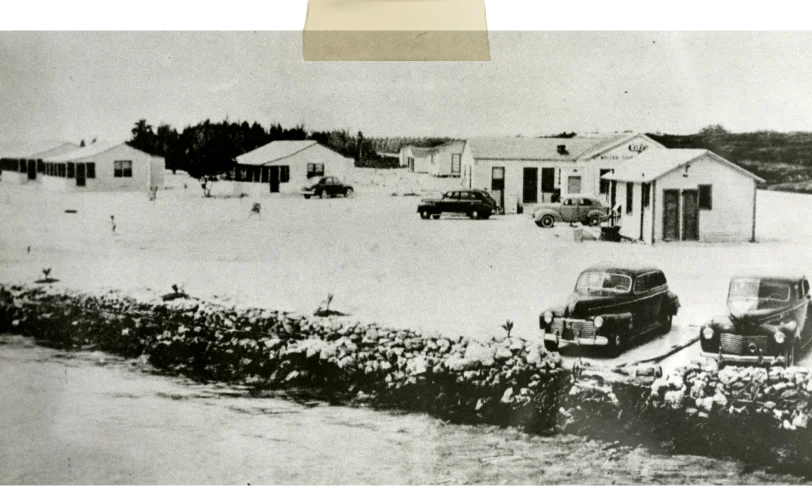
The Starck family
Before Robbie’s was Robbie’s, it was the Starck Fishing Camp. The Starck family became the first permanent Lower Matecumbe Key residents when they moved to the island in the 1940s. They first came to the Florida Keys after the 1935 Labor Day Hurricane after they purchased the Whale Harbor Fishing Camp circa 1937. Located at the eastern tip of Upper Matecumbe Key, the camp offered a dock, charter boats, cottages, and a restaurant during the busy winter season. Only the property’s gas station and bar remained open during the slow summer months. This image of the Whale Harbor Fishing Camp from the 1930s is courtesy of the Wright Langley Collection.
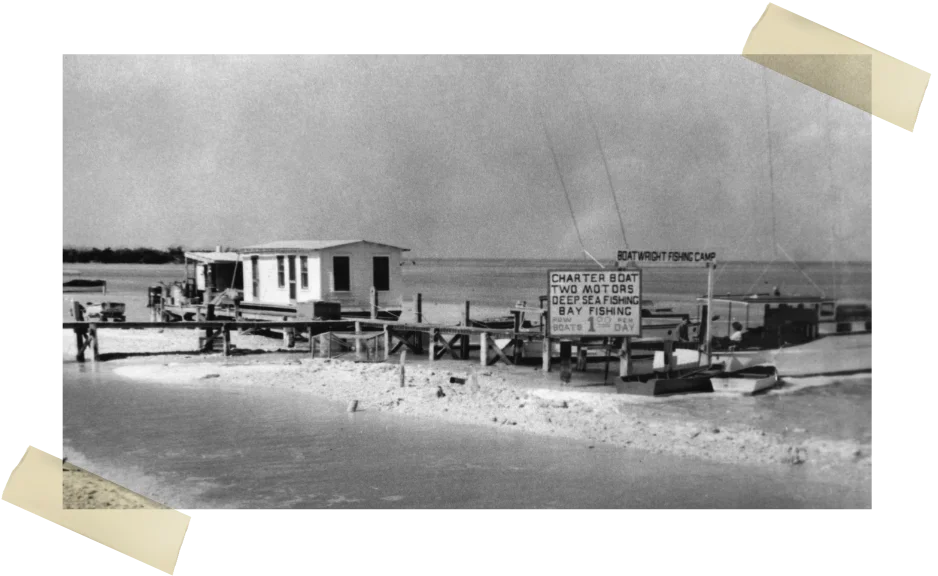
Boatwright Fishing Camp
The second permanent resident of Lower Matecumbe Key was a fishing charter captain named Angus Boatwright. The Boatwright home can still be seen next door to the Robbie’s Marina property. His Boatwright Fishing Camp operated from the railroad fill that connected Lower Matecumbe to Upper Matecumbe Keys in the 1940s. He would later run his charter boat out of the Whale Harbor Marina on Upper Matecumbe Key.
1938
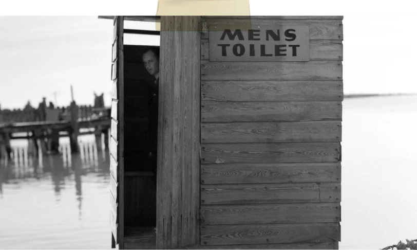
Sanitary Facilities
This image of a public outhouse on Lower Matecumbe Key was taken by Arthur Rothstein in 1938. Rothstein was the first photographer employed by the Resettlement Administration. This federal agency (which later became part of the Farm Security Administration or FSA) was established by President Franklin D. Roosevelt as part of his New Deal to help farmers and displaced workers struggling through the Great Depression. From 1935-1940, the FSA sent Rothstein on dozens of photography assignments to document communities crippled by the Depression. Rothstein’s job brought him to the Florida Keys in 1938.
1936
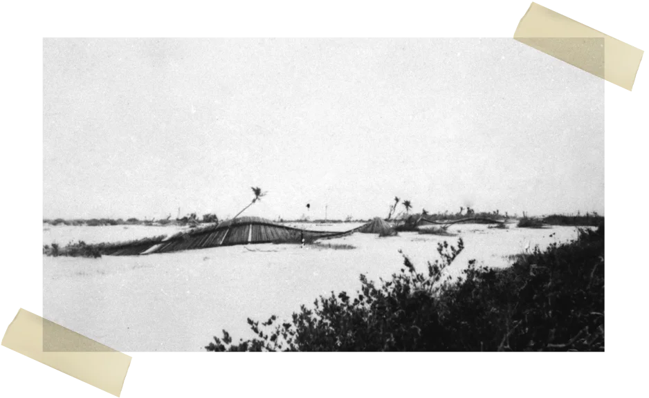
Labor Day Hurricane Destruction
The eye of the catastrophic 1935 Labor Day Hurricane passed over Lower Matecumbe and Long Keys. The Category 5 hurricane took hundreds of lives and destroyed 40 miles of Henry Flagler’s Over-Sea Railroad tracks. This image, taken on January 24, 1936, shows the twisted railroad tracks at what was once a Lower Matecumbe Key flag stop called Crevallo. The train did not regularly stop at Crevallo, which did not have a formal depot but a simple railroad platform. The train only stopped at the Crevallo platform when the engineer saw a raised flag. After the 1935 hurricane, however, the train never ran again.
1935
Labor Day Hurricane
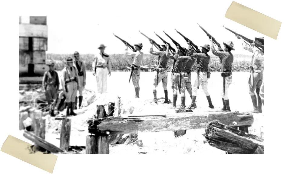
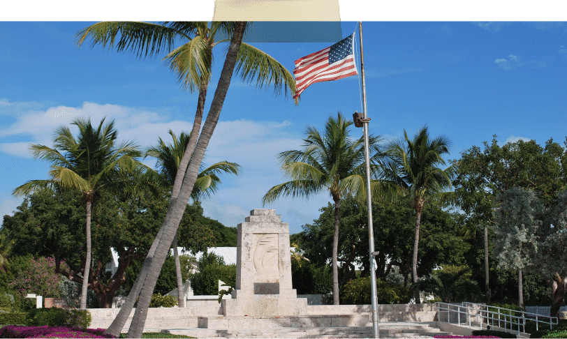
On September 2, 1935, the eye of the Category 5 Labor Day Hurricane roared over Lower Matecumbe and Long Keys. To this day, it registers as the most powerful storm ever to make landfall in the United States. Approximately 500 people died in the storm, including hundreds of WWI veterans brought in for bridge projects. The storm destroyed 40 miles of Henry Flagler’s railroad track and ended the train’s run between Key West and the mainland.
After the storm, hundreds of bodies were recovered. On September 6, Florida Governor David Scholtz ordered that cremation of the bodies was necessary to help prevent the spread of disease. The dead were placed in pine caskets, stacked, and burned at 24 sites between Plantation Key and Lower Matecumbe. Three sites were on Lower Matecumbe Key, one of which was located on what is today Robbie’s Marina. Two cremation sites were located on the other side of the Overseas Highway.
1935
Hurricane Warning
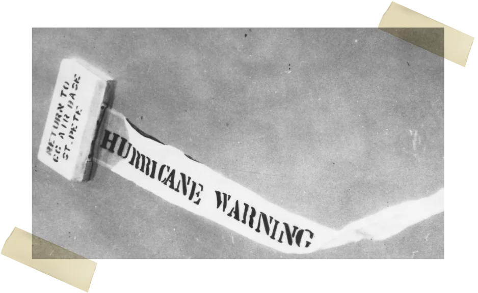
Before there was Doppler Radar and other modern weather forecasting instruments, the U.S. Coast Guard would drop Hurricane Warning boxes in remote areas. A Coast Guard plane flying overhead Indian Key dropped one of the boxes on the island to alert more than 20 people at a fishing camp on Indian Key. The small print on the box states: Return to C.C. Air Base St. Pete.
1935
Labor Day Hurricane Destruction
The eye of the catastrophic 1935 Labor Day Hurricane passed over Lower Matecumbe and Long Keys. The Category 5 hurricane took hundreds of lives and destroyed 40 miles of Henry Flagler’s Over-Sea Railroad tracks. This image, taken on January 24, 1936, shows the twisted railroad tracks at what was once a Lower Matecumbe Key flag stop called Crevallo. The train did not regularly stop at Crevallo, which did not have a formal depot but a simple railroad platform. The train only stopped at the Crevallo platform when the engineer saw a raised flag. After the 1935 hurricane, however, the train never ran again.
1934
Jewfish Bush Key
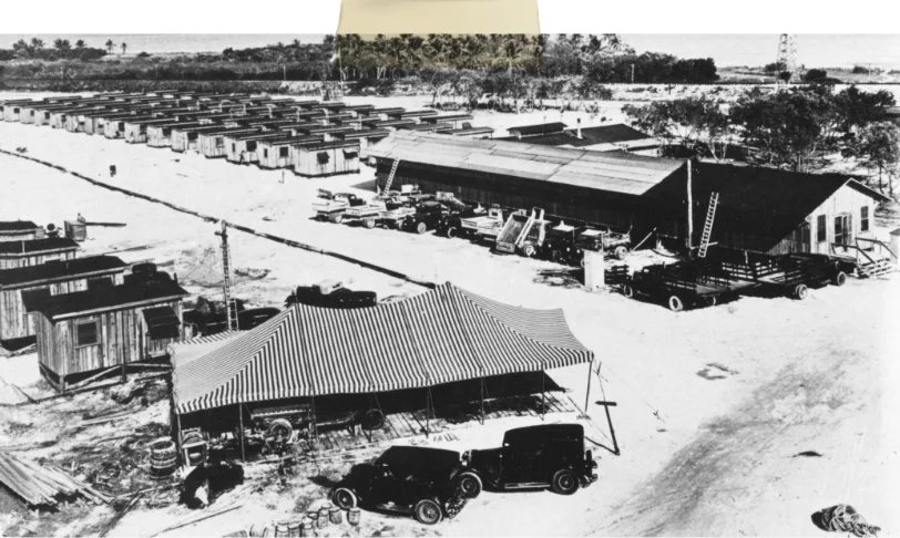
In 1934, officials decided to upgrade the Overseas Highway and build a series of solid concrete bridges to eliminate the automobile ferry system. In the Upper Keys, three work camps were established to accomplish the feat, and hundreds of WWI veterans were brought in to work on construction projects. Each camp could house up to 250 workers. One was built on Windley Key, near Snake Creek. Two were built on Lower Matecumbe Key, one at the east end of the island near Robbie’s and one at the west end near the ferry terminal. The first bridge project would have connected Lower Matecumbe Key to what was called Jewfish Bush Key then and Fiesta Key today.
1934
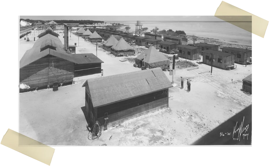
WW1 Veteran Work Camp
In 1934, three work camps were established in the Upper Keys to house WWI veterans brought to the Florida Keys to work on automobile bridge projects. One camp was at Windley Key, and two camps were located on Lower Matecumbe Key. Each base was capable of housing 250 workers. These camps were home to hundreds of veterans on September 2, 1935, the day the Category 5 Labor Day Hurricane devastated the Florida Keys.
1934
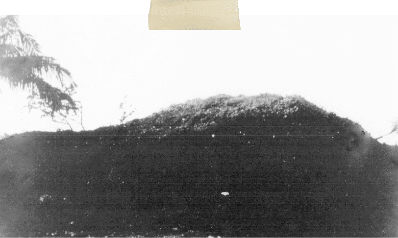
Indian Mounds
The Robbie’s property is piled high with local history, some dating back over 1,000 years. For instance, in what is today the parking lot there were two large Indian mounds. These prehistoric sites were formed when the indigenous people piled up the discarded remnants of their food staples like fish, conch, small mammals, and other protein sources. Over the course of hundreds of years, the compost piles of dirt, bone, and shell broke down to create a fertile soil that looked somewhat like coffee grounds.
1934
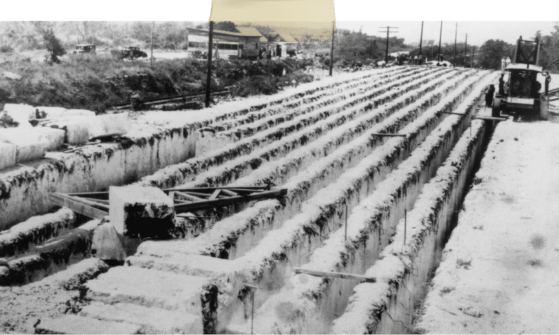
Quarry Limestone
The limestone blocks used during the building of Henry Flagler’s Over-Sea Railroad and the failed attempt at building automobile bridges between Lower Matecumbe Key and Fiesta Key in 1934 were locally sourced. During the building of the railroad, the limestone was quarried at what is today the Windley Key Fossil Reef Geological State Park. In 1934, the limestone was quarried from Plantation Key, near Mile Marker 86 where the Plantation Key Weigh Station stands.
1930
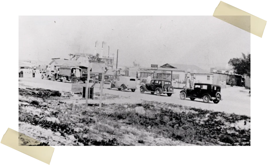
State Road 4A
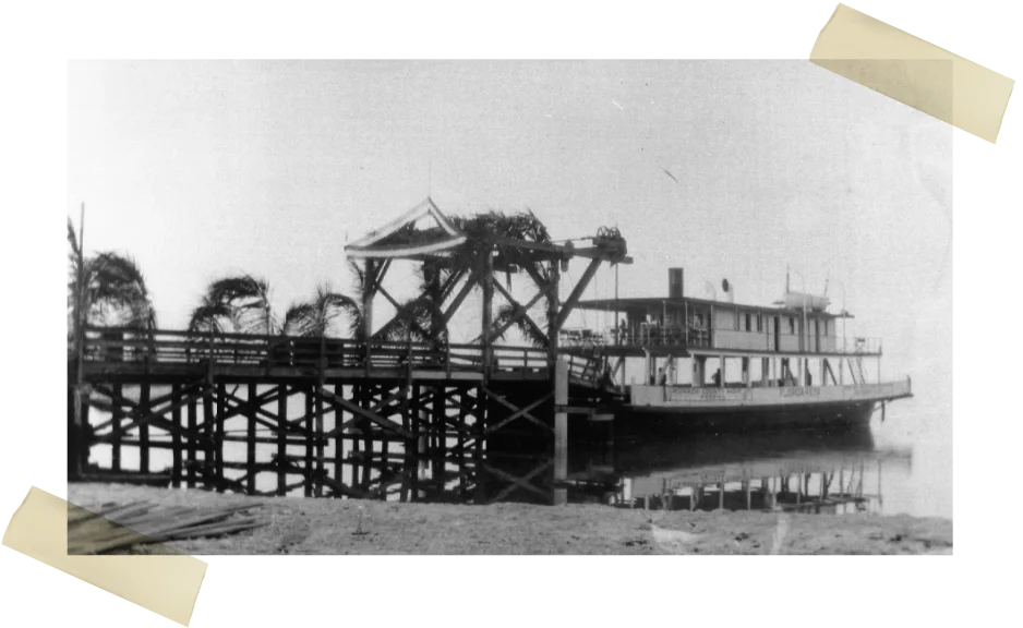
The first Overseas Highway opened in 1928. The official name was State Road 4A. While it was possible to drive a car from Miami to Key West, the road was incomplete. The road stopped at Lower Matecumbe Key and picked back up again at Big Pine Key’s neighbor, No Name Key. The 40-mile gap was bridged by an automobile ferry. This image from the Ida Woodward Barron Collection, circa 1930, shows cars lined up and waiting to board the automobile ferry at the Lower Matecumbe Key ferry terminal.
1928
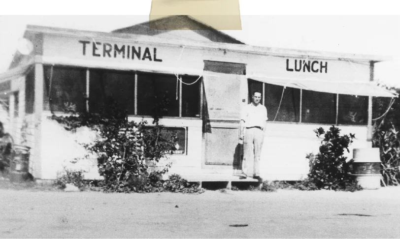
Terminal Lunch
The flat-bottom boats left the docks at the ferry terminals twice daily, at 8 a.m. and 1 p.m. It was a long trip, relatively expensive, and not a wholly reliable service as tidal extremes and weather phenomena were known to delay arrival and departure schedules. Around the ferry terminal at Lower Matecumbe, business opportunities were created, and a diner called Terminal Lunch, which also offered gasoline to waiting vehicles, was established.
When the Overseas Highway officially opened to public traffic on January 25, 1928, it did not follow the exact route it does today. The modern highway more closely aligns with the train tracks that Henry Flagler’s train once rattled and rolled across. On Lower Matecumbe Key, the original route traveled closer to Florida Bay and followed the same path as the road used to access Robbie’s Marina.
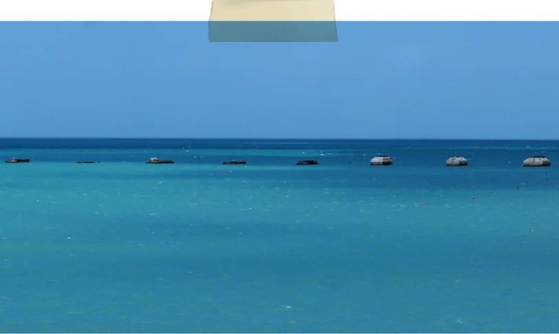
While driving over the Channel 2 Bridge separating Lower Matecumbe from Craig Key, eight concrete structures can be seen in the water on the Bayside. Some locals refer to them as “The Coffins” but they are the bridge piers built by the WWI veterans when the killer Labor Day Hurricane struck.
1920
Overseas Highway
The first version of the Overseas Highway was officially called State Road 4A. Construction began in the late 1920s. When the road was finished in 1928, it bore little resemblance to the one linking the islands today. For one thing, the road was incomplete. While it was possible to drive from the mainland to Key West, the road ended at Lower Matecumbe Key’s west end (south). Forty miles away, at No Name Key, it started again. Navigating the gap between the two points required an automobile ferry.
Aerial Lower Matecumbe
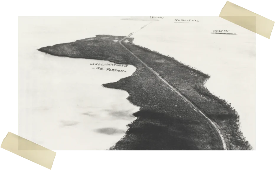
This aerial of Lower Matecumbe Key was taken circa 1920 and looks northeast to Indian Key, Tea Table Key, and Upper Matecumbe Key. No houses are visible on the island, just the tracks of Henry Flagler’s Over-Sea Railroad. It does not appear that work on State Road 4A, the original Overseas Highway, has begun. The first version of the road opened in 1928. Photo courtesy of the Wright Langley Collection, Monroe County Library
1919
Matheson House at Lignumvitae Key
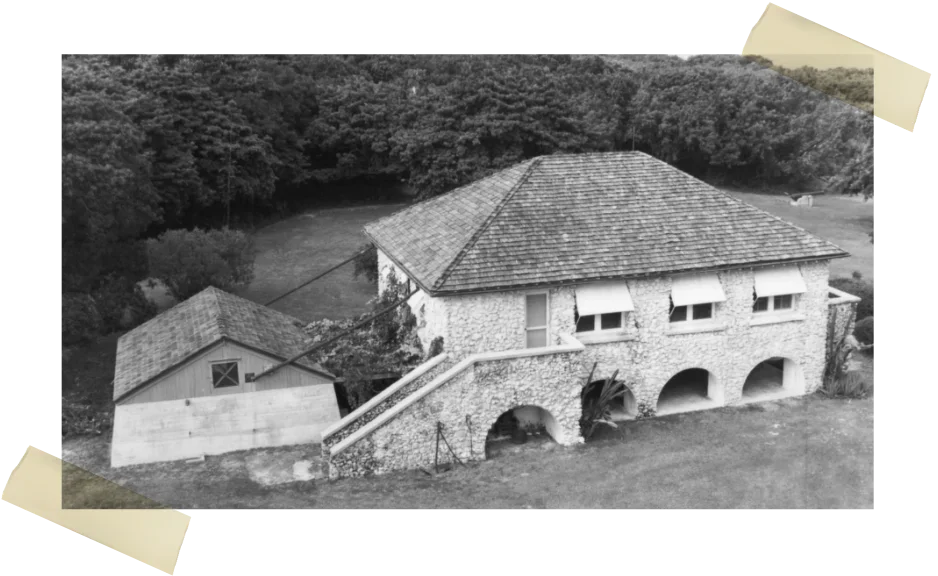
Before it became a state park, Lignumvitae Key was transferred to the Biscayne Chemical Company, owned by William J. Matheson, from 1919-1953. The four-bedroom, coral-rock Matheson House was built in 1919. Construction was done by Reynolds Cothron and his son, Alonzo, and supervised by Henry Pinder. The small building behind the house is a freshwater cistern, with rainwater delivered to the cistern via gutters linking the two structures.
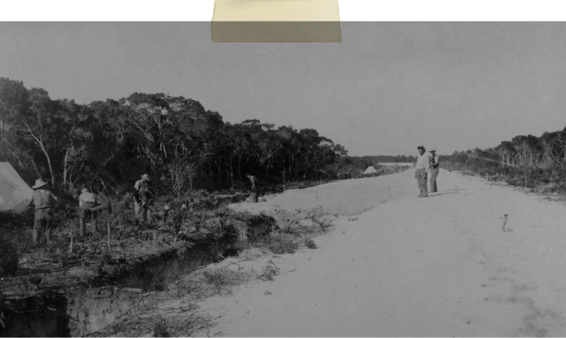
1910
Lower Matecumbe
Before the construction of Henry Flagler’s Over-Sea Railroad, Lower Matecumbe had been left largely undeveloped. By 1906, dynamite was exploding on the island as Florida East Coast Railway workers cleared a path for the train’s right-of-way. While the train did not reach Key West until 1912, daily service between the mainland and Knights Key, at the foot of the Seven Mile Bridge, was established earlier.
By 1908, the train was steaming, rocking, and rolling across Lower Matecumbe twice a day. While there were two railroad depots on Upper Matecumbe Key, Islamorada and Matecumbe, there was no formal depot on Lower Matecumbe. There was a flag stop called Crevallo on the island’s west end. A “flag stop” was not a regularly scheduled stop and did not have a depot. Crevallo had a railroad platform where the train would stop once a week if the men at the little fishing camp at that end of the island signaled the train’s engineer to stop by raising a flag.
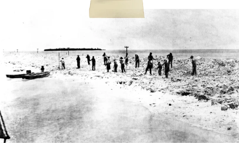
1906
Indian Key Fill looking north
Connecting Upper Matecumbe Key to Lower Matecumbe Key was a massive project for the men employed by Henry Flagler’s Florida East Coast Railway. Instead of building bridges, the men in this image taken in 1906 are working to build the fill necessary to create a solid land bridge to connect the two islands. By 1908, the train was rumbling down the railroad tracks between Miami and Knights Key, at the base of the Seven Mile Bridge, twice daily.
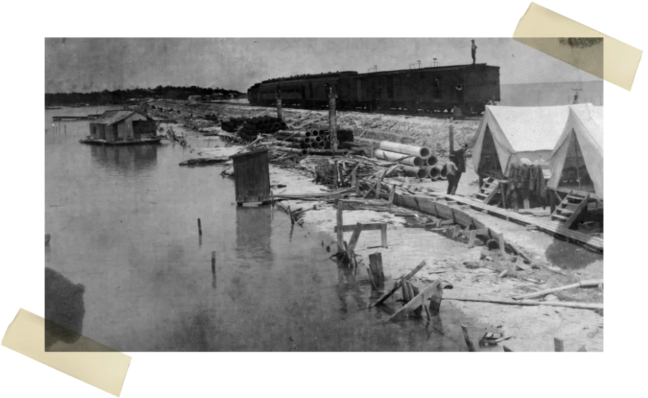
1900
The first train arriving
at the Central Supply station
This image from the Monroe County Library Collection shows the first train arriving at the Central Supply station located on the railroad fills built to connect Lower Matecumbe and Upper Matecumbe Keys. The image looks toward Lower Matecumbe Key and what, decades later, developed into Robbie’s Marina. The photo, taken in June 1907, provides hints as to how railroad workers built the fills. It also shows the contemporary bathroom facility built out over the water.
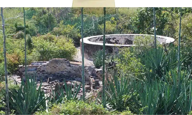
1842
Indian Key Cistern
Did you know that the round cisterns found on historic Indian Key were built by the military after they moved their depot to the island from Tea Table Key in 1840? The military used Indian Key as their base of operations through the end of the second escalation of the Seminole War in 1842.
1840
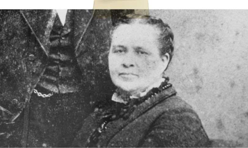
Hester Perrine
Hester Perrine, who lived on the nearby Indian Key (1838-1840), wrote about Lower Matecumbe in her memoir. “One memorable day, only three days before the Indians came to Indian Key, father and I went over, and he did but little work and then telling me that ‘he had found a place where it would be pleasant for us to lunch’ took me about a mile down the beach and then turning into the forest soon brought me to a spot where he parted the branches and there was a ‘Fairy Grotto.’
In the center was a small sparkling spring perhaps ten or fifteen feet across; various cacti in bloom and fruit, with other flowers upon the bank.” This reference is not the same freshwater source described in the 1820 document.
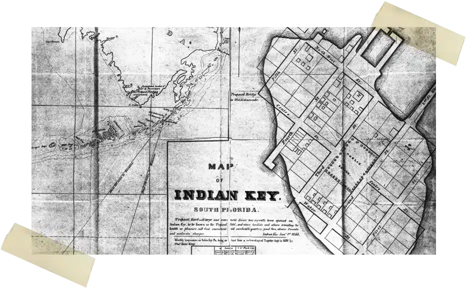
Wright Langely Collection
Once upon a time, Indian Key was the most important island in the Florida Keys, not named Key West. This map, dated 1840, shows how developed the island was before the August 1840 Indian attack during the second escalation of the Seminole War. The map shows a proposed bridge that would have connected Indian Key to Old Matecumbe (Lower Matecumbe Key). Note that on the map, Plantation Key is identified as Long Island. Photo courtesy of the Wright Langley Collection, Monroe County Library
1822
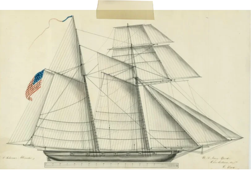
U.S. Schooner Alligator
Did you know that Islamorada’s iconic Alligator Reef Lighthouse was named after the U.S. Schooner Alligator, an 86-foot, 12-gun ship assigned to the storied anti-piracy West Indies Squadron that wrecked on the reef on November 20, 1822?
1573
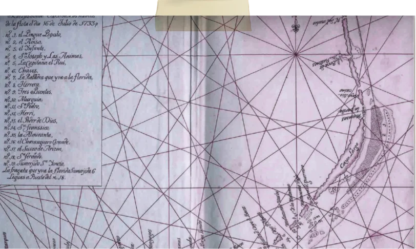
Oldest Name
Our history starts here. Matecumbe is one of South Florida’s oldest place names. In 1573, the name was written in a letter to the King of Spain. Since then, Matecumbe has always referred to two islands, Upper Matecumbe and Lower Matecumbe. For the Spanish, they were New Matecumbe and Old Matecumbe. In some cases, the names were interchangeable, with some Spanish charts identifying Lower Matecumbe Key as Matecumbe la Viejo – Old Matecumbe. The 1733 chart marking the wreck sites of the 1733 New Spain Fleet identified Upper Matecumbe as Matecumbe Viejo and Lower Matecumbe as Matecumbe Nuebo.
What To Do in Islamorada?
Robbies Marina of Islamorada is the best place in the Florida Keys to enjoy our hundreds of activities.
That was the history of how we became the most-voted place to visit in the Florida Keys.

